How to Delete Weather data & microclimate Completely
Table of Contents:
Reading time: 47 seconds
Data Weather data & microclimate collects from your device
- approximate location (network-based)
- precise location (GPS and network-based)
- view Wi-Fi connections
- view network connections
- full network access
- run at startup
- prevent device from sleeping
- receive data from Internet
1. Delete Weather data & microclimate Account through Email
There are 2 methods to get your data (and account) deleted by Weather data & microclimate : :
- Under GDPR: EU/UK Residents have the right to ask (via email), an organization that holds data about them to delete it. This is known as the ‘right to erasure’. Organizations have one month to respond to the request.
- Under CCPA: California residents have the right to request that a company delete the data/personal information it has on them. A failure to comply with this will result in a fine of upto $7,500.
Now you understand what the Law says, Send your Request directly to Weather data & microclimate using the form below:
Email Support directly
Alternatively, you can follow these steps below to get Weather data & microclimate to delete your account/data:
- To delete your Weather data & microclimate account, contact Weather data & microclimate via email and provide the reasons for your request.
- Mention the law under which you make your request (GDPR or CCPA).
- Notify Weather data & microclimate of the penalty for non-compliance - A $7,500 fine under CCPA and 4% of annual turnover under GDPR.
- Send the email to support@redacted... Click to see email
2. How to Delete Weather data & microclimate on Iphone
- On iphone, Goto "Settings "
- Click on "General" » "Iphone Storage".
- Select the app, and click "Delete Weather data & microclimate : ".
3. Delete Weather data & microclimate on Android phone
- Go to your Android phone Settings.
- Click on "Apps & Games".
- Select "Weather data & microclimate : " and Click "Uninstall".
12 details about Weather data & microclimate app
|
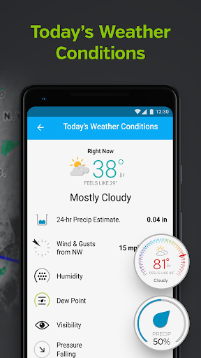
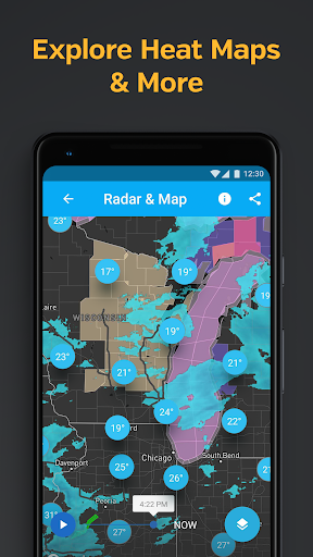
1. - Most detailed local weather data: get updates with the best weather data including weather maps, local Doppler radar imagery, temperature updates, “Feels Like,” wind speed, wind directions, today’s rain accumulation, humidity, and pressure.
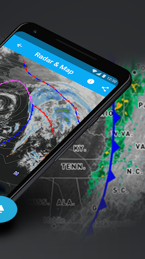
2. - The most interactive weather maps on mobile allow you to select from different precise weather overlays, personal weather stations, Nexrad radar, NOAA and satellite imagery, heat and temperature maps, and rain accumulation.
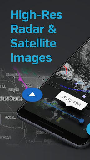
3. Discover about current conditions, get weather data from our Nexrad network, customizable weather alerts from NOAA and much more, thanks to our Nexrad hurricane and storm tracker and Doppler radar technology.
4. - Hyperlocal weather conditions: track current conditions from your local weather station, as well as hourly/daily forecasts up to 10 days in the future, which include chance of rain and precise weather news.
5. - Weather alerts and storm radar: get severe weather alerts for your position and trust our hurricane tracker and storm radar for severe weather news - you'll always be prepared for your microclimate, whether it's extreme rain or a surprise drought.
6. - Other geographical data: discover more information and get news about your local weather and microclimate with our air quality index, UV index, sunrise & sunset times at your closest personal weather station.
7. Get your hyperlocal weather forecast, with precise current conditions and hyper-local updates from your closest weather station.
8. With weather data from over 250,000 personal weather stations and a proprietary forecast model, Weather Underground gives you the most precise weather forecast at a truly hyper-local level.
9. - Keep an eye out for extreme weather with our hurricane tracker and storm radar and always be prepared with severe weather alerts.
10. - Made to fill in the gaps between the airport weather stations that other weather services rely upon to generate forecasts - meaning our data is generated from actual data points in your neighborhood.
11. - Sophisticated weather visualizations with hi-res satellite & cloud cover imagery from GOES-16, powered by data from NOAA.
Liked Weather data & microclimate? you may also like other Weather apps like Weather forecast; Weather forecast; The Weather Channel - Radar; Weather Radar by WeatherBug; AccuWeather: Weather Radar;